.png/:/rs=h:200,cg:true,m/qt=q:95)
.png/:/rs=h:104,cg:true,m/qt=q:95)
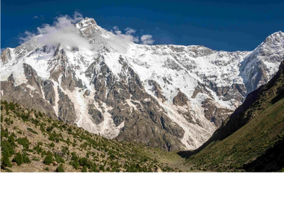
Nanga Parbat, in Pakistan’s Gilgit‑Baltistan region, is the world’s ninth‑highest peak. The journey begins with a memorable jeep ride to Tato village, followed by a steep forested ascent to Fairy Meadows. Many trekkers overnight here before continuing to Rakhiot Base Camp and returning the next day. Nanga Parbat has three main base camps—Diamer, Rakhiot, and Rupal—each aligned with its distinct faces, though the Rakhiot Base Camp via Fairy Meadows remains the most popular approach for trekkers.
Photo credit: Muhammad Ashar (Wikipedia)